1/24


Marine Ways
1K+下载次数
13MB大小
1.81(11-06-2025)最新版本
详情评价版本信息
1/24
Marine Ways介绍
免责声明:
MARINE WAYS 不代表任何政府实体,亦不提供或协助任何政府服务。
MARINE WAYS 与 NOAA 无关联,亦不代表 NOAA。
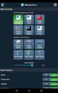
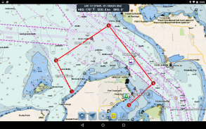
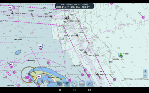
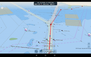
路线规划工具
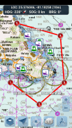
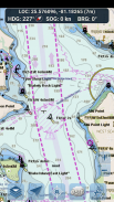
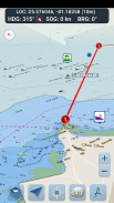
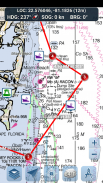
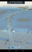
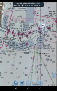
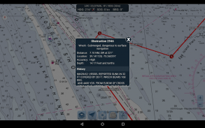
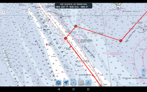
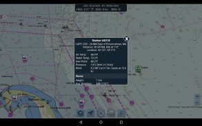
- 路线绘制。点击地图并长按一秒钟即可绘制您的航点。要创建路线,请继续在不同区域点击地图并长按。当您添加、调整或删除航点时,系统会便捷地计算并显示每段航程的距离和方位。
- 旅行模式。当您移动时,地图会自动以您的当前位置为中心。使用旅行模式可以实时查看您与绘制路线的距离!
- 路线航段摘要。便捷的视图包含您绘制的每段航程的详细信息,包括起点和终点坐标、距离和方位。
尽情使用这款应用! Marine Ways 也可在 http://www.marineways.com 网站上查阅。
Marine Ways - 版本1.81
(11-06-2025)新特性Clarify terms of subscription plan.Ads will be removed and the app will continue to operate when internet connection is not available when the user subscribes to our $1.99/month monthly subscription plan. The subscription plan can be cancelled at any time via the Google Play Store app, under subscriptions.
Marine Ways - APK信息
APK版本: 1.81程序包: com.marineways.android名称: Marine Ways大小: 13 MB下载次数: 102版本: 1.81发布日期: 2025-06-11 11:07:39最小屏幕: SMALL支持的CPU: x86, x86-64, armeabi-v7a, arm64-v8a
程序包ID: com.marineways.androidSHA1签名: 5D:D6:E6:3D:20:FF:C0:E4:0B:B2:AB:B2:F6:42:DB:57:5C:7A:A4:35开发商 (CN): ArpeggioSoft LLC组织 (O): 本地 (L): 国家/地区 (C): 州/市 (ST): 程序包ID: com.marineways.androidSHA1签名: 5D:D6:E6:3D:20:FF:C0:E4:0B:B2:AB:B2:F6:42:DB:57:5C:7A:A4:35开发商 (CN): ArpeggioSoft LLC组织 (O): 本地 (L): 国家/地区 (C): 州/市 (ST):
Marine Ways的最新版本
1.81
11/6/2025102 下载次数13 MB 大小
其他版本
1.79
11/6/2025102 下载次数13 MB 大小
1.77
12/5/2025102 下载次数15 MB 大小
1.75
2/4/2025102 下载次数15 MB 大小
1.74
20/3/2025102 下载次数10 MB 大小
1.61
4/2/2025102 下载次数10 MB 大小
1.55
24/1/2025102 下载次数9.5 MB 大小
1.43
21/1/2025102 下载次数6 MB 大小
1.28
14/3/2023102 下载次数3.5 MB 大小
1.1
10/7/2018102 下载次数3.5 MB 大小


同类应用


您可能还会喜欢……

English


